
For contracting officers and procurement
Capability statement
Blue Horizon Drone LLC leverages advanced thermal imaging, aerial inspection technology and decades of aviation expertise to deliver actionable intelligence that helps clients identify problems, reduce risk and make data-driven decisions.
Company information
Blue Horizon Drone, LLC
- Company name
- Blue Horizon Drone, LLC
- Business classification
- Veteran-Owned Small Business
- Primary service area
- Shenandoah Valley, Virginia and the Mid-Atlantic region
- Website
- BlueHorizonDrone.com
- mike@bluehorizondrone.com
- Phone
- (540) 480-6270
Core capabilities
What we deliver
Thermal imaging and infrared inspections
- Building envelope assessments
- Roof moisture intrusion detection
- Electrical system hotspot identification
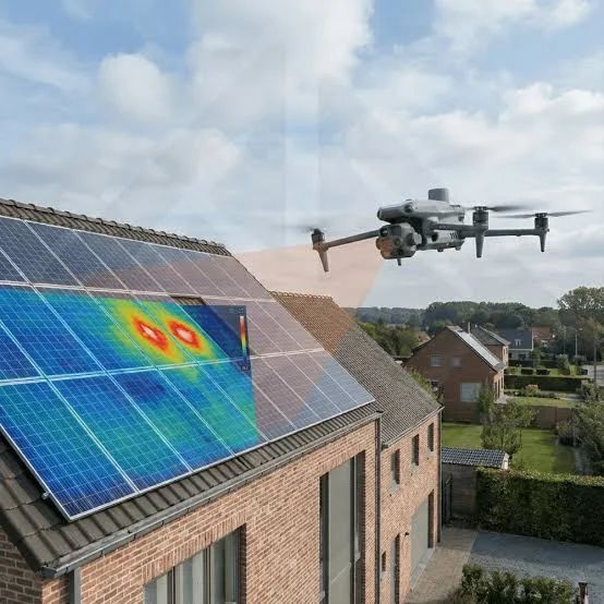
- Solar photovoltaic inspections
- Agricultural and livestock monitoring
- Equipment condition monitoring
- Preventive maintenance surveys
Aerial mapping and geospatial data
- Orthomosaic mapping
- 2D and 3D modeling
- Construction progress documentation
- Site and land development surveys
- Environmental monitoring
- Wildlife and habitat assessments
Inspection services
- Commercial and industrial facilities
- Utility infrastructure
- Agricultural operations
- Real estate due diligence
- Insurance documentation
- Post-storm damage assessments
Differentiators
Why Blue Horizon Drone
- FAA Part 107 Certified Remote Pilot
- FLIR Certified Thermographer
- Veteran-Owned Small Business
- 28 years of Naval Aviation leadership and maintenance experience
- More than 5,000 hours of military aviation operational experience
- Specialized focus on thermal imaging and actionable data collection
- Rapid deployment capability throughout the Shenandoah Valley
- Professional-grade aerial and thermal sensor platforms
Equipment
Aircraft and sensors
Aircraft
- DJI Matrice 4T
Sensor capabilities
- Radiometric thermal imaging
- High-resolution visual imaging
- Optical zoom inspection cameras
- GPS-enabled mapping and survey data collection
- Day and night operations (as authorized)
Markets served
Who this work is for
Agriculture
Commercial real estate
Construction
Utilities
Manufacturing
Property management
Insurance support services
Economic development organizations
Local government agencies
Environmental and conservation organizations
Codes
NAICS codes
- 541922
- Commercial Photography
- 541370
- Surveying and Mapping Services
- 541990
- All Other Professional, Scientific and Technical Services
- 541690
- Other Scientific and Technical Consulting Services
Service area: the Shenandoah Valley and the Mid-Atlantic. Rapid deployment throughout the Shenandoah Valley.
Request the statement as a document
Contracting officers and procurement teams: call or email and I will send the capability statement in whatever format your system wants it in.